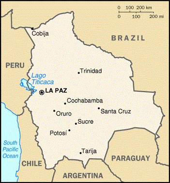
At 424,135 mi² (1,098,580 km²[1]), Bolivia is the world's 28th-largest country (after Ethiopia). It is comparable in size to Mauritania, and is half again as large as the US state of Texas.
Bolivia is a landlocked nation; it lost its connection to the Pacific coast in the War of the Pacific in 1879. However, it does have access to the Atlantic via the Paraguay river. The west of Bolivia is situated in the Andes mountain range, with the highest peak, Nevado Del Sajama at 6,542 metres (21,463 ft) located at the department of Oruro. The landscape encompasses many different backgrounds, which provide a beautiful view in one of the most incredible natural experiences one can experience. The west of the country is formed by a highland plateau, the Altiplano. The east of the country is lowland, and covered by the Amazonian rainforests. Lake Titicaca is located on the border between Bolivia and Peru. In the west, in the department of Potosí, lies the Salar de Uyuni, the world's largest salt flat.
Major cities are La Paz, Santa Cruz de la Sierra and Cochabamba.


No comments:
Post a Comment